No. 2 · In the works
Journey Posters
One trip, one sheet. The whole route drawn at wall scale, with your photographs set along it.
The printing arm of KR Maps. Everything here begins with places you actually went — your photographs, your routes, real geographic data — and ends as something printed, on heavy stock, in your hands.
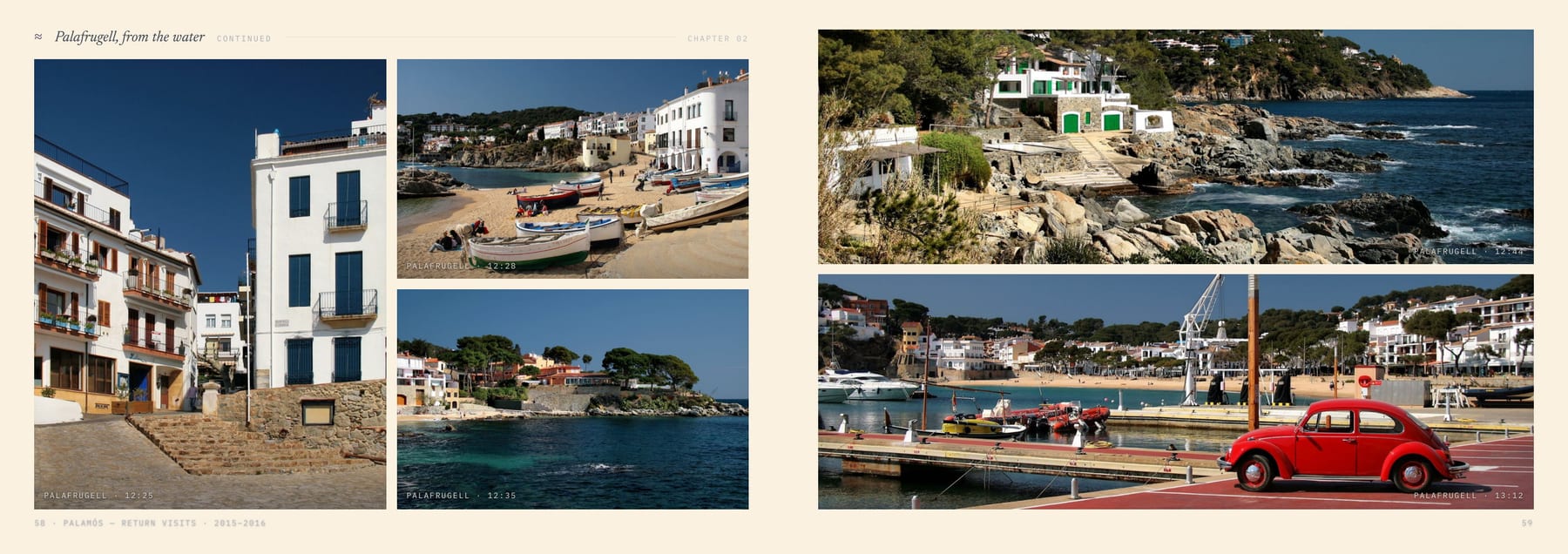
A hardcover book of one trip, rebuilt from the photographs themselves — chapters, captions, and your actual route drawn onto real maps of the places you went. Drop in a trip; a finished draft comes back in minutes.
Same maps, same photographs, different object. These are in production now. Leave an address and we’ll write once, when the first sheets come off.
No. 2 · In the works
One trip, one sheet. The whole route drawn at wall scale, with your photographs set along it.
No. 3 · In the works
A single photograph, printed to archival standard with the place and the day it was taken set beneath it.
Looking for the wall maps? Ten years of them, printed and framed, still live on the main site.
Go to krmaps.com →
Drop in a folder of trip photos. Travel Books rebuilds the journey from them — maps, order, every place — and prints it as a hardcover book.
Drop in a folder of trip photos. From nothing but the when and where each one carries, Travel Books builds the whole journey back — the maps of every route you took, your photographs in the order they happened, each place its own moment — then prints it as a hardcover book you keep.


116 of them. Unsorted.
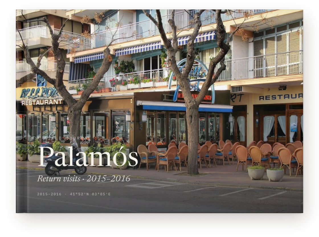
One of your own frames, titled and dated.

Every road you actually took, drawn onto real maps.

All of them, in the order they happened.

Each place you stopped becomes its own chapter.
One folder of photos became this 72-page hardcover in about four minutes, cover to back.
Try it with your trip
The route, drawn one last time.
Every palette KR Maps has been putting on walls for years is here for your pages. Settle on one and every map in the book follows it.
Read straight off an ordinary camera roll.
Clear, overcast, or rain — each day’s weather is read back and kept beside its pages.
Learn more
A hike carries its numbers — distance, gain, high point — and a summit earns a 3D landscape, your route drawn up it.
Learn moreClusters of days become chapters, even two visits a year apart.
Learn moreTime and place in every frame are enough to tell what each moment was.
Learn moreThe printed article
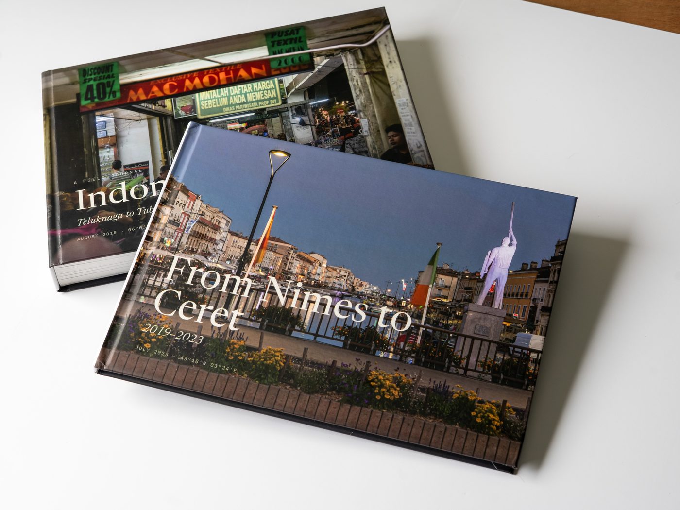
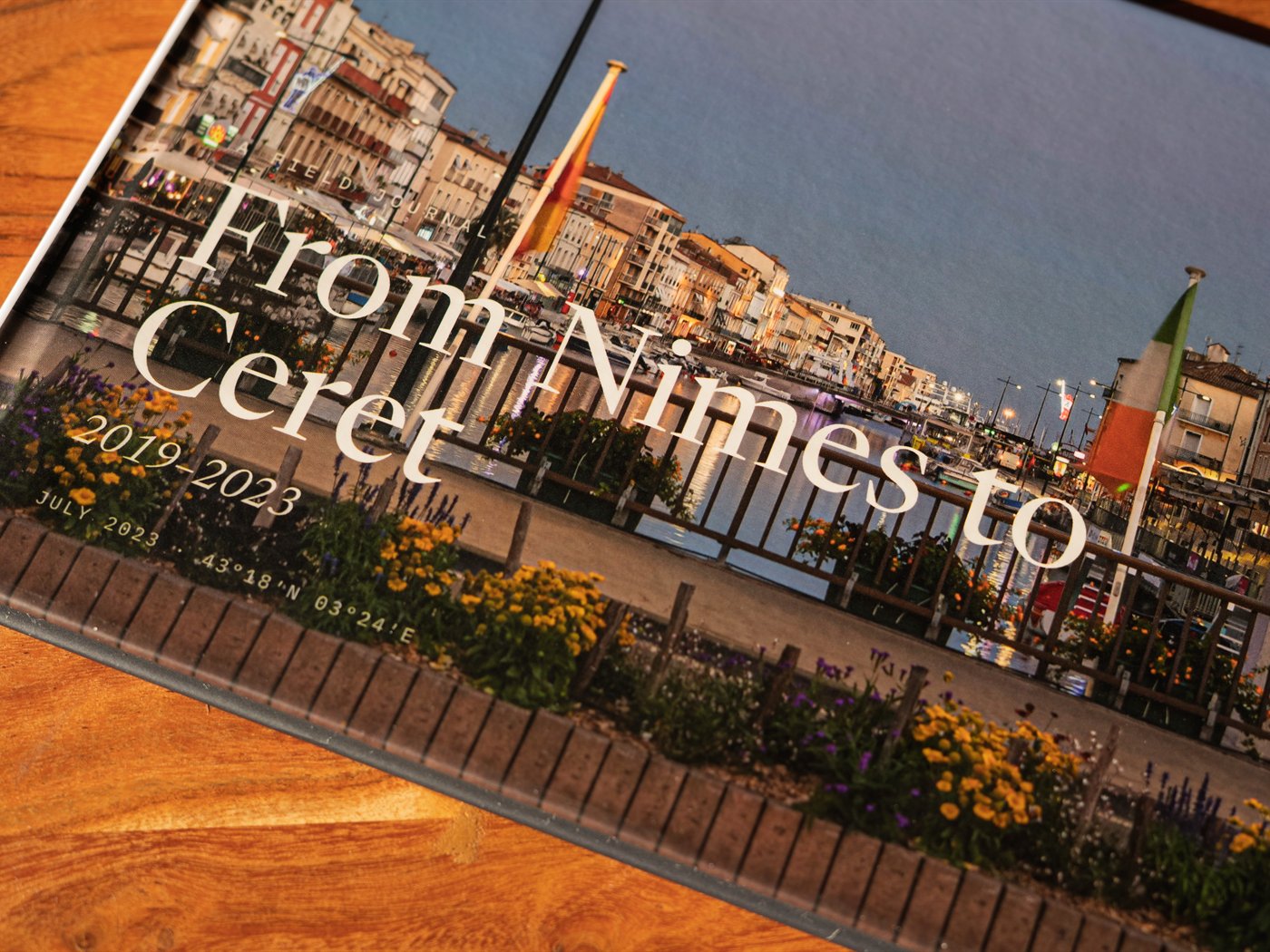
Hardcover, lay-flat, 300 DPI — photographed as it arrives.


In print now
One trip, hardcover, maps drawn from your photos. You’re here.
In the works
The whole route on a single sheet, at wall scale.
In the works
One photograph, archival stock, its place set beneath.
Pick a trip and see the first draft of your book in minutes. You only pay when you order a print.
You lived the story; your photos kept the notes. Travel Books reads them back — the days, the places, the roads between — and hands you a finished first draft. Everything on this page is an unedited export from a real book.
Every photo you take already carries a time and a place. Drop a trip in, and each shot lands where you took it, the route threads between them, the chapters find themselves, and the whole journey becomes the opening spread of your book.
292 photographs, straight off the phone. Each already carries the only two facts that matter — a when and a where.
Gaps in time and jumps on the map split the pile into moments. No albums, no sorting, no tagging.
Each moment lays out its own pages — a chapter opener, spreads of your photographs, the day’s map drawn between them.
A real export — Indonesia, 14 days, 292 photographs, the route drawn from the photos’ own GPS. No templates, no sorting, no design skills required.
That’s all a Travel Book needs. The whole journey reassembles itself and becomes your opening spread, before you’ve typed a word.

Your photos are read here, in this browser — no upload, no account, and nothing that looks at your pictures. They only travel when you choose to save a book link, invite someone to add theirs, or order the print. To draw the maps and fill in each day’s weather we send a few coordinates and dates: a dot on a map, never a photograph.
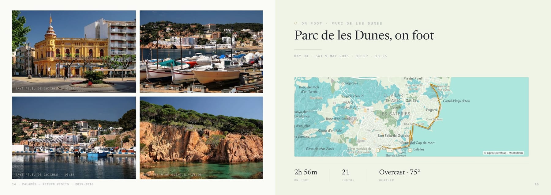
Each map is drawn at the scale that stretch of the trip earns — a crossing wide, a day on foot down to the street. And it reads how you moved — a drive becomes a getting-there page, a hike gets its trail, a market morning gets a street-level map with every photo pinned.
Every chapter opens on a map drawn from real geographic data and printed at 300 DPI, in styles made to echo the palettes of our wall maps.
The path you traveled is traced point-to-point across the page, so the book tells the where of the trip.
Chapters, captions, and layout are drafted for you, then every word and page is yours to edit.
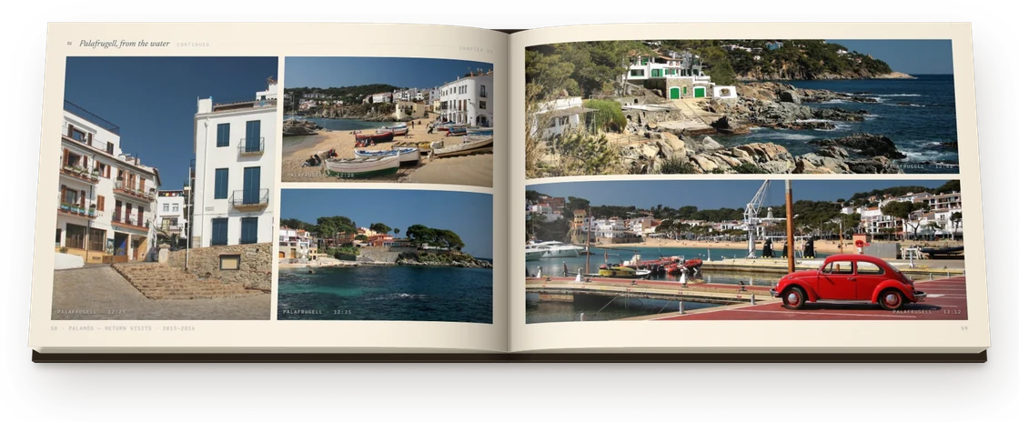
Spread after spread of pictures, in the order you took them. A map turns up when a day needs placing, then the photographs pick straight back up. Twelve spreads in a row from one chapter, nothing skipped.
33 of the 52 spreads in this book are photographs. The maps are the other third. They’re there to say where you were.
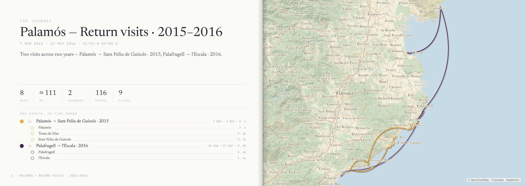
A cluster of days in one place. A clear break. Another cluster somewhere new. That shape becomes the table of contents, and every chapter opens on the whole journey, with its own stretch lit and the rest left faint around it.
Several stops in a week, a real climb, the sky on a given afternoon — the trip’s own signals decide what each spread becomes. You don’t ask for any of it.
Your camera wrote a time and a coordinate into every frame. Plain arithmetic on those turns them into acts — a morning that never moved, a line across water, a climb — and asking the map what stands at those coordinates says what each act was.
Fourteen readings, shown here across one 14-day journey through Indonesia.
A named landmark under every frame, and two hours barely moving.
A marketplace on the map, and a morning that never left it.
A restaurant on the map and a table held for most of two hours.
A stage or theatre named at the centre of the frames.
A reserve polygon around the frames, and animals named inside it.
A named beach under the cluster, and nothing stronger to go on.
A harbour at one end, then a line no road could have followed.
Walking pace inside a quarter that has a name of its own.
A purposeful line over wild ground, climbing most of the way.
Climbed onto the highest ground in the book, and the peak has a name.
A station at one end, then a straight, sustained line at rail speed.
Every frame inside the last of the light. The one reading that needs no map.
Every frame after dusk. Lamplight, and shutters held open.
The map offers nothing to name it by. It still earns a spread, and the words are yours.
Nothing on these cards was typed in. Times, spans, distances and heights are arithmetic on the timestamps and coordinates already inside your photographs; the names — the market, the reserve, the peak, the quarter — come from looking those coordinates up on the map. Every number is yours to type over. The line about what actually happened is the part we leave to you.
A trip that winds through several stops — or returns to the same place twice — sorts itself. The builder reads the shape of your days and organizes the photos into moments automatically.
A real climb reads as a hike from the frames alone, and the book keeps the numbers. Distance, elevation gain, high point and time moving are computed from the timestamps, coordinates and altitudes your camera already writes, printed in a ledger beside the day’s own elevation profile. Photograph the walk as you go and those same frames become the trail: a map of the path you actually took, drawn point to point.
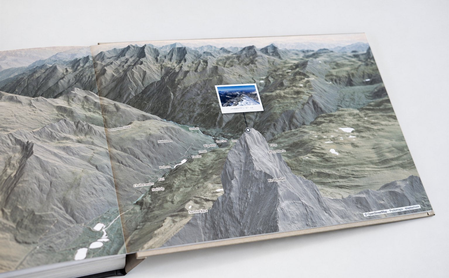
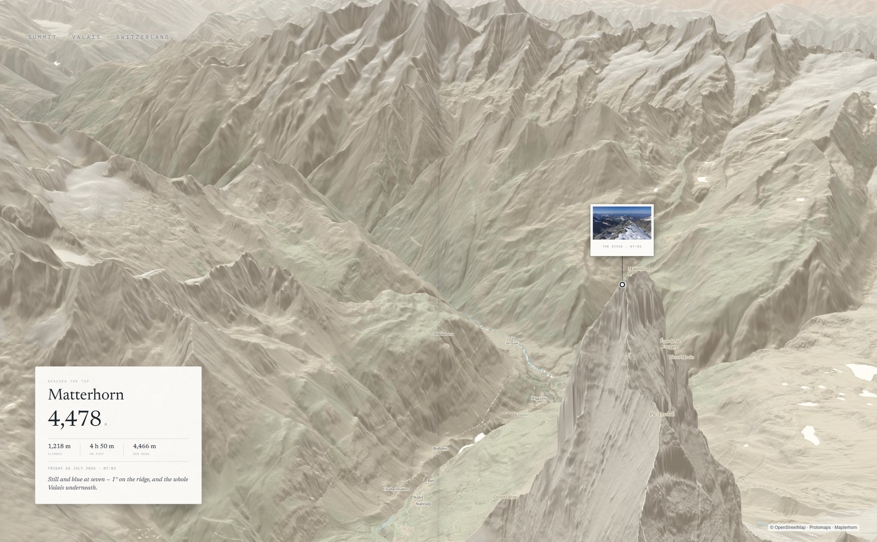
And when you top out, the summit earns a spread of its own — an immersive 3D landscape of that very terrain, your route drawn up it. A fully customizable scene.

Clear, overcast, or rain — the sky from every day of your trip is read back and kept beside its pages.
The same palettes that have been going on KR Maps walls for years now set the maps inside your book. Choose one and the whole book follows it, a weekend on foot or half the world.
A city, on foot
At street level the palette has the most to say: every park, canal, rail line and block takes its colour from the one you choose.
The open road
Out of town the land does the talking — relief, forest, coastline and the roads between them, all drawn in the same style.
Across the world
Actual exports — fourteen of the thirty-seven styles, each set loose on a journey of its own.
Coastlines, terrain, and place names are rendered from real geographic data, and many of the book’s map styles were designed to echo the look and color palettes of the wall maps we’ve made for the last ten years. Your route is then drawn across the top, one point at a time, exactly where you went.

Two bindings, one size, printed at 300 DPI on heavy stock with a matte-laminated hard cover. Everything below is the real specification we send to the press.
Hardcover
From $43.95
Case-bound with a printed cover and a squared spine. The classic photo-book feel. It stands on a shelf and holds its shape for decades.
Lay-flat — best for maps
From $84.95
Hinged so every spread opens almost completely flat. A map that runs across the fold stays readable all the way through the middle.


The route, the timing, the places, the light — that part happens on its own. Which moment mattered most was always going to be your call.
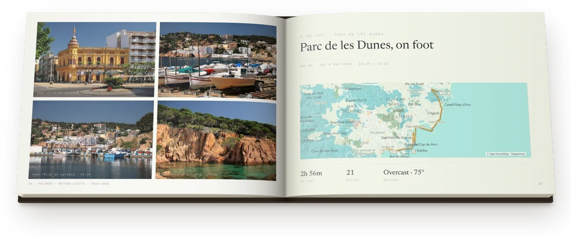
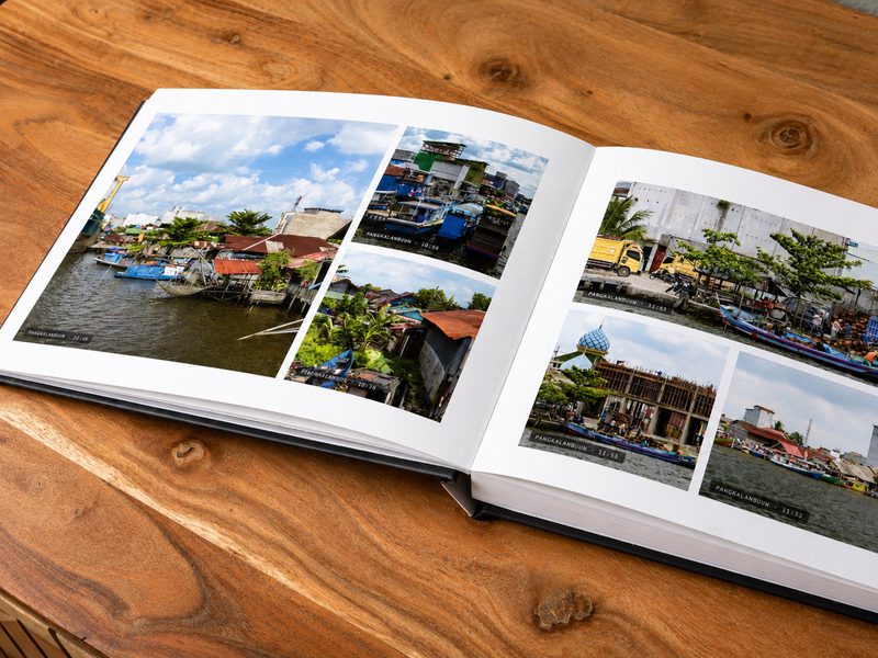
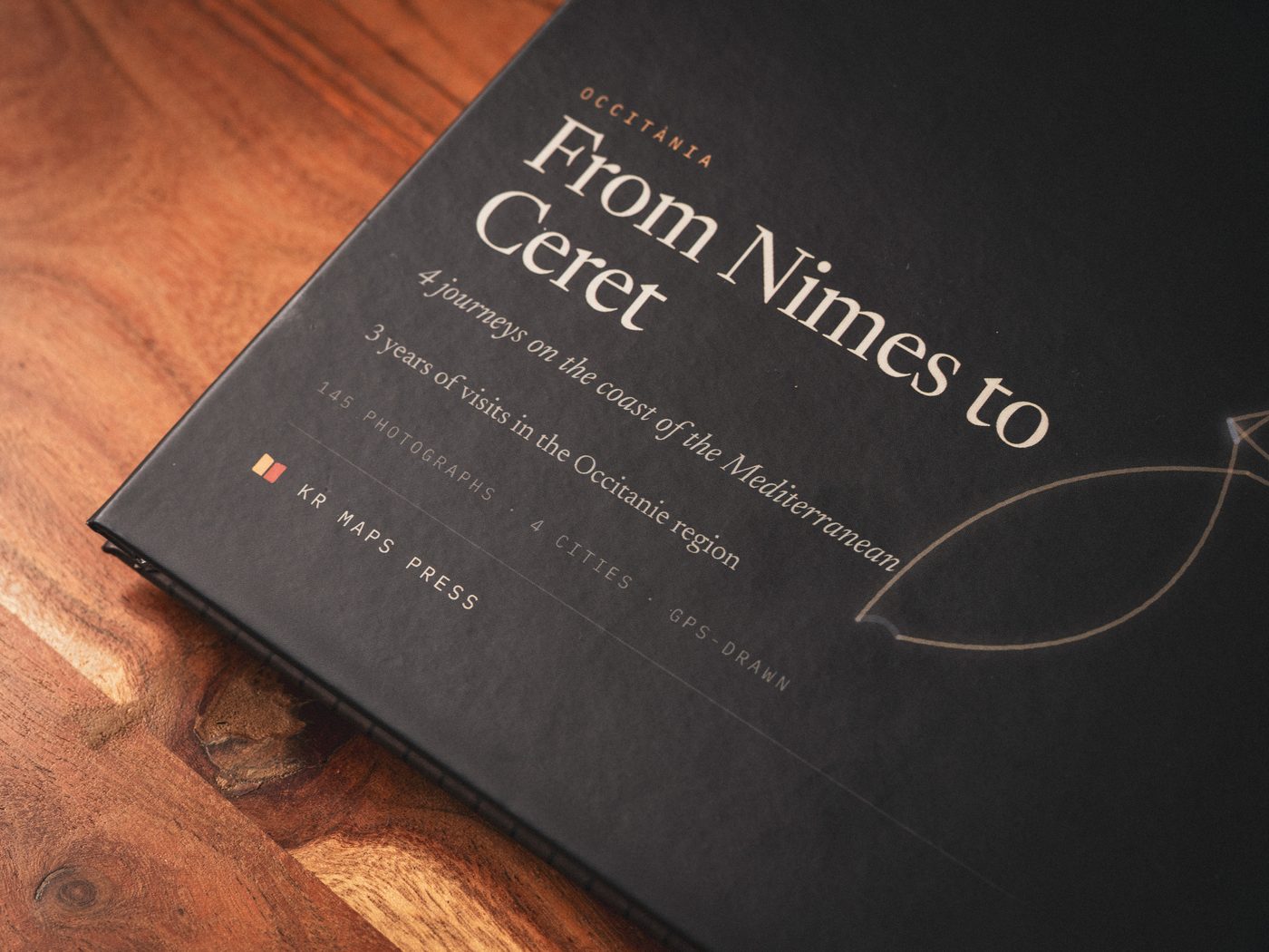
Everywhere else on this site you are looking at design files. Here you are looking at the object — two finished Travel Books, one from a fortnight across Indonesia, one from four trips along the Occitanie coast, both made the same way you would make yours. Tap any photograph to see it full size.
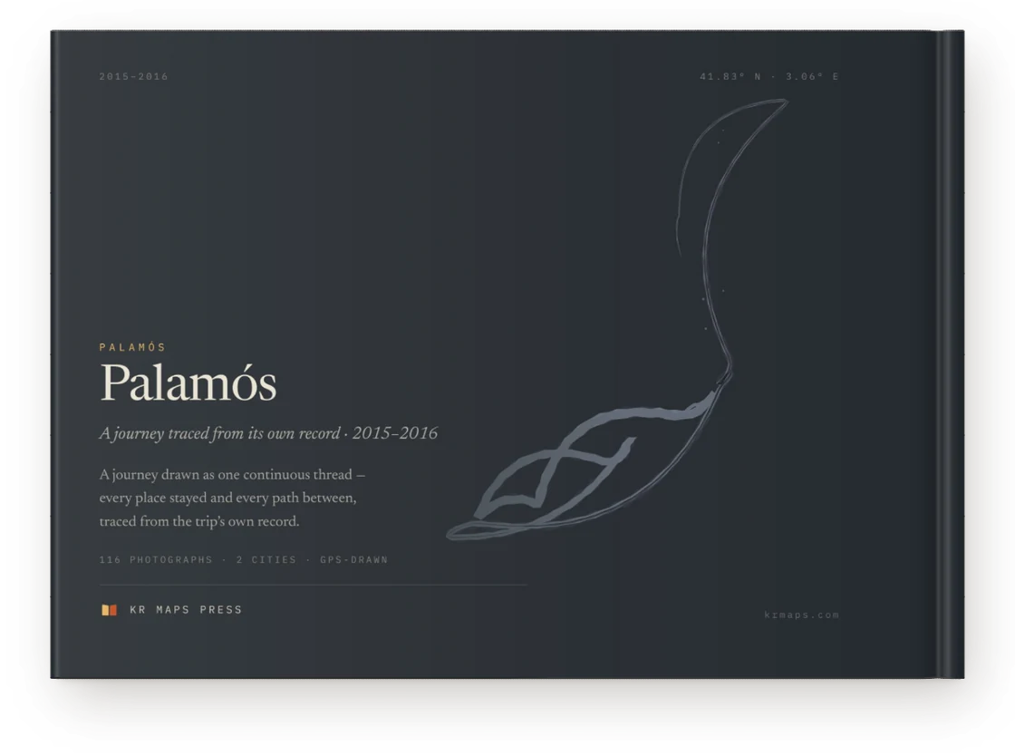
The cover is yours to choose: a photograph from the trip, or the route itself drawn on plain board.
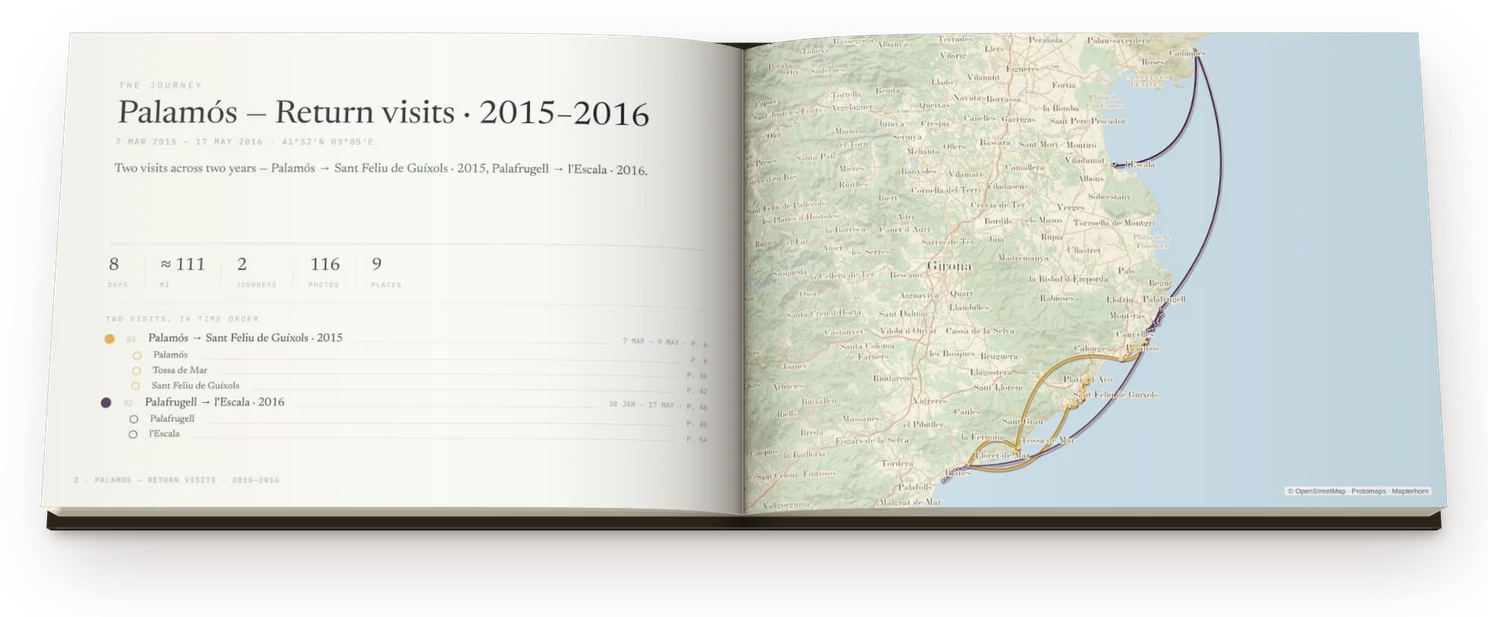
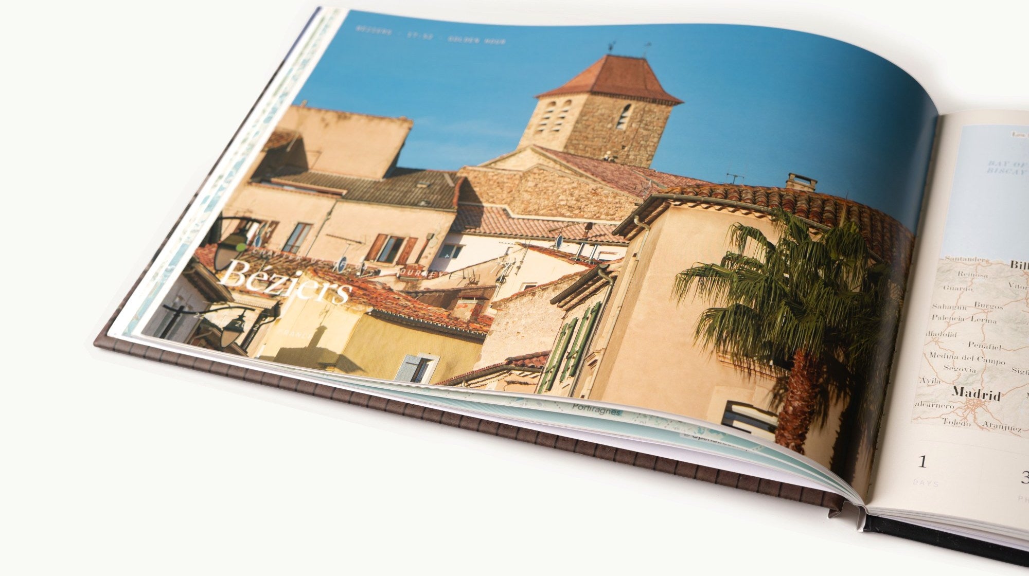
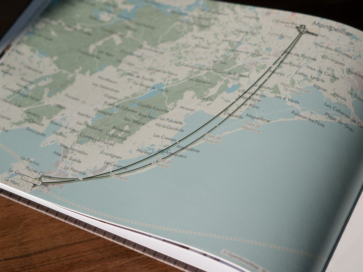
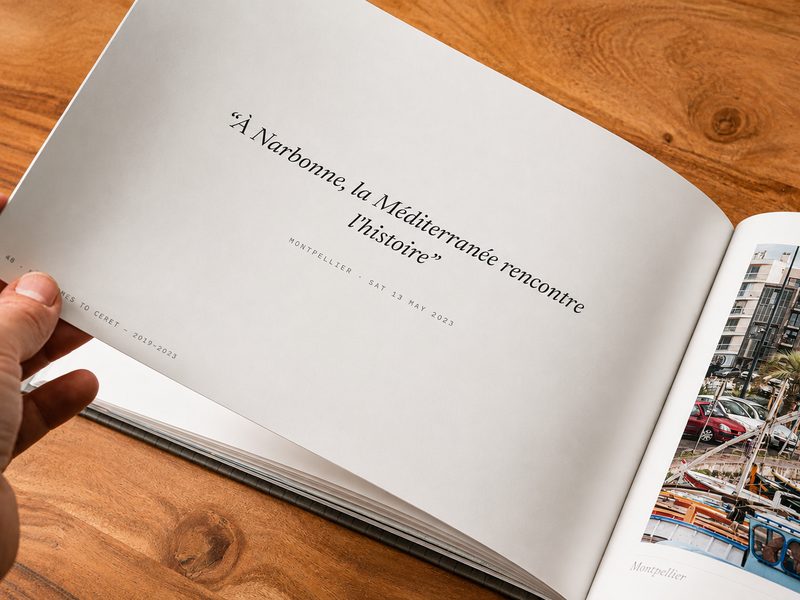
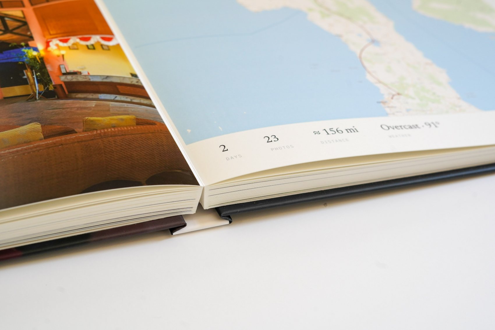
Chapters open on the place they cover. Maps print across the gutter at full spread width. Every figure on the page — distance, weather, the time of day — came off the photographs themselves.
Heavy stock, printed both sides, bound to open flat enough to read a map across the middle.
The line is drawn from your actual track, one colour per journey, and printed at 300 DPI on real cartography, not an illustration of a map.
These five are exported pages, not photographs — the same files that go to the press, shown flat so nothing sits between you and the page. Everything above this line came off a camera.
Nine map palettes and the terrain settings that produced these live on How it works.
Same binding, same paper, same press. Different trip, different maps, different photographs. Drop a trip in and a finished draft comes back in minutes.
Everything else is included — maps, layout, captions, 300 DPI printing, U.S. shipping. Build the whole book free; pay only when you order.
Hardcover from
$43.95
24–300 pages
Lay-flat from
$84.95
18–122 pages

The everyday keepsake
Case-bound, squared spine, stands on a shelf for decades. 24 to 300 pages on heavy 200 gsm gloss paper.
The showpiece — best for maps
Matte-laminated cover, lay-flat binding. Spreads open almost completely flat. 18 to 122 pages on 190 gsm gloss stock.
Prices in USD. Page tiers are a ceiling — a 60-page book prices at the 72-page tier. Free standard U.S. shipping on every order.
A map of your actual route opens every chapter, at no extra cost.
Your book is composed for you, then fully editable.
On heavy gloss stock — 200 gsm hardcover, 190 gsm lay-flat.
Standard shipping is on us, everywhere in the U.S.
Lay out your whole book before you spend a cent. Pay only when you’re ready to print.
Making a book, editing it, what happens to your photos, and how it gets to your door.
Quick links
No answer here uses that word. Try a plainer one — paper, price, edit — or ask us directly.
What you need, and where the first draft comes from.
Start from the web studio or the KR Maps Journeys app and pick a trip. We compose the whole book — maps, chapters, captions — the travel journal you never had to keep. Then you rearrange, rewrite, and refine it. When it looks right, choose a binding and order.
No. Journeys is how you gather a trip; a Travel Book is how you keep it — and you can do both in the web studio without ever installing the app. Journeys is a free, optional companion that gathers your travel photos and matches them to places — handy, but never required.
Yes. Building and previewing your whole book is free. You only pay when you place a print order.
The first draft is composed for you in minutes, so there’s no layout work to do. However long you spend after that is up to you — order it as-is, or linger over favorites and captions.
Yes. Save and finish later hands you a private link that reopens your book on any computer for 30 days from your last edit. Opening or re-saving resets the clock. There’s no account and no password; the link itself is the key, so keep it to yourself. You can also have it emailed to you.
Bindings, size, paper, and how many pages fit.
Hardcover is a classic case-bound book, durable and giftable. Lay-flat uses thick, rigid pages that open completely flat, so a photo or map can run seamlessly across the whole spread. Lay-flat is the premium option; hardcover is the everyday keepsake.
A4 landscape — about 11.7 × 8.3 inches — a generous, wall-map-worthy canvas for your photos and routes.
That depends on the binding. Hardcover runs 24 to 300 pages, priced in seven tiers (40, 72, 104, 152, 200, 252, 300). Lay-flat runs 18 to 122, in four (40, 72, 104, 122). A big multi-stop trip or a full year of adventures usually lands well inside the early tiers.
Heavy gloss stock — 200 gsm in the hardcover, 190 gsm in the lay-flat — printed at 300 DPI, with a matte-laminated cover on both. The same standard we hold our wall maps to.
Captions, chapters, maps, and other people’s photos.
Yes, everything. Rewrite the intro, edit every caption, add or remove photos, and rearrange chapters and pages until the story reads the way you remember it.
Your route is drawn automatically from where you traveled. You can adjust how each map is framed and zoomed so the part of the journey you care about takes center stage.
Yes. Bring in a single journey or a whole multi-stop trip. Each leg becomes its own chapter with its own map.
Yes. From the studio you can send a private, upload-only link. Whoever you send it to can add their shots to your book, and nothing else: they can’t see your book, edit it, or order it. Their photos arrive in your gathering and you decide what stays.
Where your pictures live, and what we never see.
Arithmetic. Every photo carries a timestamp and coordinates, and speed, spacing, altitude, and the shape of the path are enough to tell a hike from a drive from a day at sea, and one trip from another. Nothing ever needs to look at your pictures.
On your own device. They’re read here in your browser and stay put — nothing is uploaded until you choose to save a book link, invite someone to add their photos, or order the print. To draw your maps and fill in each day’s weather we look up a few coordinates and dates: a dot on a map, never a photograph.
No. Your photos are never viewed by us or any AI, and are permanently deleted shortly after your book is delivered. The only way we ever see them is if you hand them to us: when you ask for help from inside the studio there’s a tick-box, off by default, that lets us open your book to see what you’re seeing. Leave it alone and we get your words and nothing else. See our privacy promise.
Your print file is held only long enough for our print partner to produce and ship your book, then deleted. If you saved a cloud draft, it’s kept for 30 days from your last edit — opening or re-saving resets the clock — and then removed automatically.
Prices, shipping, and putting things right.
Hardcover starts at $43.95 and lay-flat at $84.95, by size. See the full breakdown on the Pricing page.
Standard U.S. shipping is free. Books are printed to order, so allow time for production plus transit.
Reach out and we’ll make it right.
Tell us what you’re trying to do and we’ll walk you through it. A real person in Colorado reads every message.
A plain-language summary of how KR Maps Press handles your photos and data.
Last updated — July 2026
The photos, captions, and trip details you add to a book, plus basic order and contact information when you buy.
While you create, your photos stay on your device. They aren’t uploaded unless you choose to save, collaborate, or order your book, and once your book is ready to print, they’re never viewed by us or any AI, and are permanently deleted shortly after your book is delivered. The only way we ever see them is if you hand them to us: asking for help from inside the studio offers a tick-box, off by default, that lets us open your book to see what you’re seeing. Leave it alone and your message arrives with your words and your page count, nothing more.
Nothing is uploaded until you choose to save a book link, invite someone to add their photos, or order your book, and we ask before the first upload ever happens. Ordering begins the upload when you go through to review your book, not at payment, so the print files are ready when you are. From then on, your book link keeps itself up to date as you edit, so your work is never lost and ordering takes seconds.
To print your book we share the finished file with our print partner, who keeps it only long enough to produce and ship your order, then deletes it.
Saved cloud drafts are kept 30 days from your last edit — opening or re-saving resets the clock — then deleted automatically. No account is required to build a book.
Questions about your privacy? Get in touch.